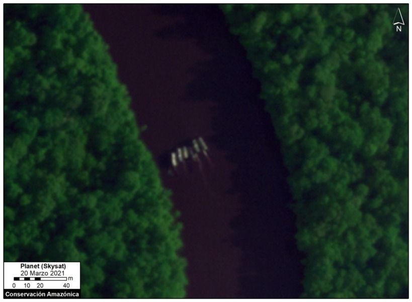
Illegal activity affects a protected area. Dredges are located near the town center and were recognized thanks to new high-resolution satellite technology. This type of illegal mining is also practiced in rivers in Ecuador and Colombia.
In the northern Amazon, located in the Loreto region, a new type of illegal mining is practiced, one in which small dredges are used on rivers. A new report from the Monitoring of the Andean Amazon Project (MAAP) shows, through the use of new advanced satellite technology, how this illegal extractive activity is located in the Nanay and Pintuyacu rivers of the Loreto region.
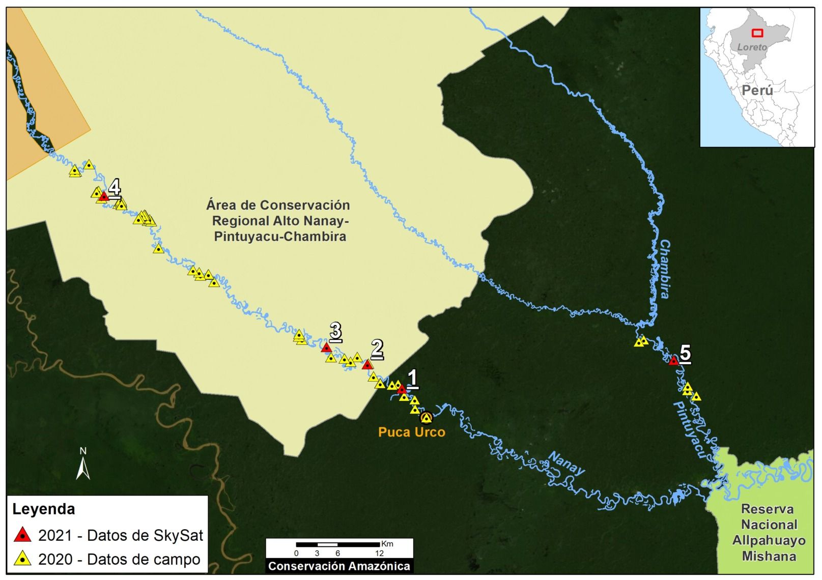
The MAAP report registers the presence of illegal mining dredgers in 2020 and in the present 2021. The areas of the rivers with the presence of dredges are located within the Alto Nanay-Pintuyacu-Chambira Regional Conservation Area.
The presence of illegal mining in these areas threatens the health of the population of the town of Puca Urco, but also of the entire capital of Iquitos. "These rivers (Nanay and Pintuyacu) are the main sources of drinking water in the city of Iquitos (capital of Loreto)," is quoted in the MAAP report.